Showing posts with label rain. Show all posts

Thursday, 29 December 2011

2011 - A Year of Extremes, and More To Come...


Firstly, I hope you all had a great Christmas! It is this time of year that makes you really grateful for just the basic things in life. We are now fast approaching 2012 and is a good time to reflect on the past 12 months.

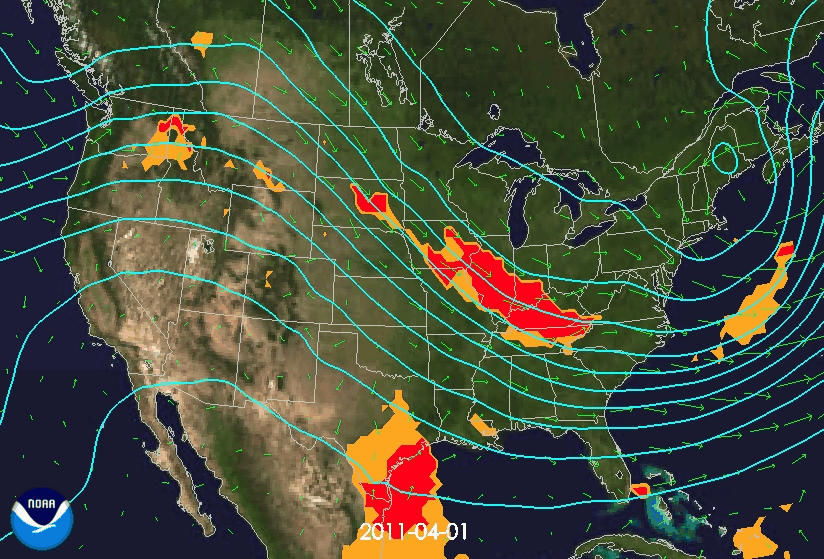
I don't think anyone can doubt that 2011 has had it's fair share of extreme weather events. December has seen the devastating monsoon in the Philippines that killed over 700, Scotland battered by a storm with wind speeds in excess of 165mph, whilst flooding in Kenya displaced thousands. November saw a mounting death toll in Cambodia after thousands were left stranded after monsoon conditions. In October residents fled Bangkok as flooding threatened to overwhelm the capital at the time when Texas was facing a dust cloud 8,000ft high, and the UK was facing it's highest October temperatures on record.  There was also the freak snow storm along the US east coast which killed 11 and left millions without power, only two weeks after hurricane Irene had ripped through the Caribbean and the south-east. September had seen even more destruction for Texas in which huge wildfires destroyed hundreds of homes. Going back to May, the world witnessed one of the most extraordinary tornado sequences ever caught on camera with more than 165 in just 24 hours in the Missouri area. March saw the most devastating natural event of the year in which Japan was hit by a double tsunami leading to 20,000 deaths and millions of pounds of damage. Cyclone Yasi has long been forgotten, but struck the Australian coast only back in February, tearing roofs of houses and bringing power lines to the ground. Going right back to the beginning of the year, January saw 400 killed as a result of torrential rain and mudslides in Brazil, there was flooding in Sri Lanka which forced 300,000 from their homes, as well as flash floods in Queensland.

Climate change sceptics may suggest that we are just becoming more 'aware' of extreme events since the 'global warming' hype of the 1980s but from research over the past few months, and the experience of extreme weather events in my lifetime I can only come to the one conclusion that anthropogenic climate change is a primary driving factor in the increasing frequency of these extreme events.

An extract from the Scientific American, dating back to June, summarises this nicely through the results of one of the worlds largest insurance companies Munich Re. The company has compiled the world's most comprehensive database of natural disasters, reaching all the way back to the eruption of Mount Vesuvius in A.D. 79. The records are kept with extreme interest by financial companies, in order to successfully evaluate insurance risks. On average 700-1000 natural disasters are added to the database each year. Their data shows a small increase in geologic events such as earthquakes since the 1980s, largely down to better reporting. However, increases in the number of climate disasters is 'far larger'

Peter Höppe, head of Munich Re's Geo Risks Research/Corporate Climate Centre:
 "Our figures indicate a trend towards an increase in extreme weather events that can only be fully explained by climate change... It's as if the weather machine had changed up a gear."

In the latest SREX report, we have seen the IPCC state:

"There is evidence that some extremes have changed as a result of anthropogenic influences, including increases in atmospheric concentrations of greenhouse gases."

Direct cause and effect literature has been hard to come by in the past, but this year has seen a significant increase not only in literature suggesting increasing likeliness of climate change on extreme events, but also as direct attribution. This does not mean however that every extreme event is a direct result of anthropogenic climate change. For example, solar forcing causing winter lows which I looked at in a previous post, can be assigned to natural variability. There has always been extreme events, and always will be as a result of natural variability, but the latest findings point to both an intensification and frequency of such events as a result of human impact. Over time with better climate model simulations, greater understanding of the hydrological cycle (specifically with vorticity and wind speed), and an increase in data collaboration and research papers, will I'm sure, only pile on greater evidence that extreme weather is slowly becoming the new normal (unless human anthropogenic impact is significantly minimised or reduced).

All I can conclude with is a warning: Extreme Weather Ahead.
Signing off for 2011.


Monday, 7 November 2011

165 Tornadoes in 24 Hours


The weather witnessed in Southeast US earlier this year was phenomenal. Over 600 tornadoes were recorded in April alone, breaking the previous record by several hundred. Numerous F5 tornadoes (the highest grade) with surface wind speeds greater than 200mph were also witnessed. The result was widespread and devastating destruction, including the deaths of more than 350 people. In Alabama, between 1950 and 2006, 358 people have been killed as a result of tornadoes. In the 30 day period of April 2011, 240 people were killed in Alabama.


Why so many tornadoes?

The high number of tornadoes was partly due to the Arctic Oscillation which was in a negative phase. High pressure in northern Canada, pushed the cold arctic air a long way south. On top of this, the sea surface temperatures in the Gulf of Mexico were a couple of degrees above where they should have been for the time of year.  The resulting evaporation meant warm humid air residing off the southeast coast of the US. A southerly breeze, brought this warm humid air inland, and mixed with the cold air, creating a very active weather front. In this situation, the warm air rises up above the cold air and it begins to interact with the jet stream. The jet stream was further south than it should have been and this is partly due to the La Nina phase of the ENSO oscillation. As the warm air rises and meets the cold air, almost instantaneously as a thunderstorm develops, you get the twisting motion as a result of the cold and warm air meeting with the jet stream. The twisting motion produces the tornadoes which then eventually reach the surface. The image below shows the air movements and tornado reports across April 2011.


The daily evolving 500mb heights (contours) and 850mb wind (arrows) from April 1-30, 2011.  Index: category 4 (orange) indicative of enhanced severe storm risk and category 5 (red) indicative of enhanced tornado risk. Source


A paper published in 2008 looked at whether tornado counts change location based on phase of El Nino/ Southern Oscillation. However, results found that neither frequency of tornado days nor days of violent tornados is affected systematically by the phase of ENSO for the US as a whole. Rather that ENSO only sets a ‘background stage’ for which tornado activity to occur in.
“The apparent response of organized tornado activity to ENSO phase is a nonlinear one driven by meteorological processes rather than conditions in the tropical Pacific. Neither ENSO extreme (warm nor cold phase) is related to as significant of an increase in organized tornado activity as the intermediate neutral phase is.”
Currently further research is required into the contribution of La Nina, and NOAA observational sources suggest that the tropical sea surface temperature conditions played a much larger role in what was witnessed in April 2011.


Anthropogenic Climate Change and Tornadoes

In order to assess long term climate trends, reliable long term data is required, which makes the assessment of tornadoes and climate change difficult. The US Climate Change Synthesis Report SAP 3.3 concludes that:
"The data used to examine changes in the frequency and severity of tornadoes and severe thunderstorms are inadequate to make definitive statements about actual changes."
"There were no significant changes in the high-intensity end of these distributions from the 1950s through the 1990s, although the distribution from 2000 and later may differ."

The historical record of tornado counts should always be treated with care. In some states, tornado counts have doubled in the last two decades, but this may be due to non-meteorological changes. Changes in use of equipment which result in large numbers of F0 (weakest) tornadoes being recoded which previously weren't, account for this rapid change in the recent totals (see records from Illinois below). Population growth and spotter networks also increase the amount of tornadoes witnessed and reported. Death tolls are also not necessarily that useful. In May 2004, 384 tornadoes were recorded, but only 7 deaths. In 2008, only 40 tornadoes are on record, but more than 100 people were killed. The high death toll years are often a result of just several tornadoes hitting urban centres with high populations.

a)

b)
The annual number of tornadoes per year in Illinois since 1950, regardless of strength (a) and F0 only (b). Source
"There is insufficient evidence to determine whether trends exist in.....small-scale phenomena such as tornadoes, hail, lightning and dust-storms."

Another paper on the analysis of climate change projections suggests that the number of days during which meteorological conditions are favourable for severe storms may increase during latter decades of the 21st Century, primarily due to increased instability as a result of anthropogenic forcing. However, the research projected decreases in vertical wind shear, which as a result may oppose thermodynamic destabilization. In such a case, there may not be a discernable link between tornados and climate change, which rely on increases in wind shear to form.

In summary, more research is clearly required to better understand how ENSO and its multi-year life-cycle may influence the probability of major, destructive tornado outbreaks over the US. The relation is likely to be more complicated than the simple state of the tropical Pacific sea surface temperatures. There is a large body of knowledge rapidly evolving over the possible role of large scale climate forcing caused as a result of anthropogenic impact, on tornado outbreaks. In order for this to be more successful, efforts need to me made in linking meso-scale meteorology with global-scale climate dynamics. Watch this space...

Monday, 31 October 2011

Floods in England Caused by Anthropogenic Greenhouse Gases


Scenes such as those in Uckfield in the above video were witnessed all across England and Wales in October and November 2000. It had been the wettest autumn since records began in 1766 - the map below outlines total rainfall and percentage increase above average for the time of year. Over 10,000 properties were flooded and the costs as a result of the damage exceeded £1bn.


In a recent paper published in Science, a group of scientists have been attributing flood risk and anthropogenic climate change as a result of the extreme events in 2000. As mentioned in previous posts, only general explanations are usually offered for any expected increase in flooding. They usually revolve around thermodynamic arguments for precipitation extremes, an example of which can be found here.

In this recent paper a seasonal-forecast-resolution climate model was used to create two scenarios. One realistic scenario whereby actual twentieth century climate was modelled (including atmospheric pollutant concentrations) and a second hypothetical scenario to represent climatic conditions as they might have been had anthropogenic greenhouse gas emissions not occurred. Atmosphere-ocean linkages were taken into account alongside sea surface temperatures and sea ice cover. The scenarios could then be run multiple times and runoff rates could be compared between natural and anthropogenic conditions.

The study outlines that there were sequences of intense weather systems bringing heavy precipitation pulses to catchments multiple times throughout the day in Autumn 2000. This was characterised by the displacement of the North Atlantic jet stream (see image below) bringing more intense systems further into western Europe. 


This resulted in many catchments becoming saturated. Daily river runoff was examined using a simple hydrological runoff model and the climate scenarios were compared.


The above diagram is a summary of their results, showing that the fraction of risk attributable to twentieth century greenhouse gases are significant relative to the natural conditions (without anthropogenic impact). The black line is an aggregate relative to the full natural baseline conditions.

Model Results:
In nine out of ten cases, the model results indicate that twentieth century anthropogenic greenhouse gas emissions increased the risk of floods occurring in England and Wales by more than 20%, and in two out of three cases by more than 90%.

These results are yet another step towards providing evidence of how extreme weather events are a direct result of human anthropogenic change. But again I will give a word of caution - changes in built environment (concrete over natural environments) could have played a part in historical model simulations in recent years (affecting both run-off and return time). Furthermore, just because an event-type becomes more likely, does not meant that it will become even more likely in the future - but it does highlight the potential impact of climate change..

Tuesday, 25 October 2011

"It's Raining Cats and Dogs" – Briefly putting the science aside

I alluded to the phrase ‘It’s raining cats and dogs’ in my last post, but failed to display the significance of this. In the English language it is a phrase often used to describe very heavy rainfall. If you are looking for innovative scientific research, then skip on to my next post, but for a few fun facts, carry on reading!

The origin of the phrase began in the early 18th century where in the filthy streets of 17th/18th century England, heavy rain would occasionally carry along dead animals and other debris. The animals didn't fall from the sky, but the sight of dead cats and dogs floating by in storms could well have caused the coining of this colourful phrase.

Jonathan Swift described such an event in his satirical poem 'A Description of a City Shower', first published in the 1710, and I will leave you with the words of his famous poem:

Now in contiguous Drops the Flood comes down,
Threat'ning with Deluge this devoted Town.
...
Now from all Parts the swelling Kennels flow,
And bear their Trophies with them as they go:
Filth of all Hues and Odours seem to tell
What Street they sail'd from, by their Sight and Smell.
They, as each Torrent drives, with rapid Force,
From Smithfield or St. Pulchre's shape their Course,
And in huge Confluent join'd at Snow-Hill Ridge,
Fall from the Conduit, prone to Holbourn-Bridge.
Sweeping from Butchers Stalls, Dung, Guts, and Blood,
Drown'd Puppies, stinking Sprats, all drench'd in Mud,
Dead Cats and Turnip-Tops come tumbling down the Flood.

Monday, 24 October 2011

It's Raining Cats and Dogs


Four scientists based at the Climate Research Division in Ontario, Canada have recently made this bold statement. They have carried out research looking at past changes in the characteristics of extreme precipitation events. For a number of years now it has been suggested that humans may have played a role through climate change in creating the increase in heavy precipitation, but as mentioned in previous posts it has always been difficult to actually prove.

In this study they used historical climate data from between 1951 and 1999, mainly focussing on the Northern Hemisphere where data is more readily available and accurate. They used observed daily observation data from over 6000 stations alongside the CMIP3 (Coupled Model Intercomparison Project) archive for model simulations.

In order to assess anthropogenic impact segments of the historical data were used in the  simulations with either:
 - Historical anthropogenic forcing (greenhouse gases, and other anthropogenic factors such    as aerosols)
- Combination of historical natural (solar and volcanic forcing) plus anthropogenic forcing
- Unforced control simulations

They looked for ‘fingerprint patterns’ in the simulation outputs, and regression coefficients that were obtained were significantly greater than zero, indicating that anthropogenic influence is readily detectable from the historical data.


The above image displays geographical distribution of trends of extreme precipitation indices during 1951–99. A and b are Observations; C and D are model simulations with anthropogenic forcing; E and F are model simulations with anthropogenic plus natural forcing. For each pair of panels, results are shown for annual maximum daily (RX1D) and five-day (RX5D) precipitation amounts. The units used are per cent probability per year.

The paper outlines that these changes in extreme precipitation follow the Clausius-Clapeyron relationshipWhereby there is an exponential increase of atmospheric moisture with warming, as the atmosphere can hold more water at warmer temperatures.

What’s their punch line?

“Human-induced increases in greenhouse gases have contributed to the observed intensification of heavy precipitation events found over approximately two-thirds of data-covered parts of Northern Hemisphere land periods.”

Moreover, they claim that there results may in fact be an underestimate, due to the modelling process. As a result, extreme precipitation events may strengthen more quickly than what has been projected and may have more severe impacts than estimated. Either way it would appear that we are likely to experience an increase in extreme precipitation events over the coming decades if anthropogenic impacts continue.

As a final comment of caution, it is always worth remembering that there are always uncertainties and limitations in the observed data use in studies such as these. There are also questions over missing or uncertain external forcing’s which could account for some of the difference between the observed and simulated data. Models are also never perfect and its reliability also needs to be considered. Despite these things, this paper presents a significant step in what would appear to be the right direction and should be taken as scientific fact, unless proven otherwise.

Wednesday, 12 October 2011

Coincidence or Causality?


New to the blogging world, I will keep my fist post short and sweet, a flavour of what's to come, if you will.Why start my blog with this video? Well, quite simply because it is a video that answers absolutely nothing. 

The video does however make you think by asking a lot of questions. After personally experiencing a blistering, record breaking 29.4 degrees Celsius in the UK on the 2nd October, it is not uncommon to create a logical connection between climate change and these extreme weather conditions. Is there a much bigger link to it all, or are they just freak anomalies? 

This blog will flirt around with thoughts, news stories and academic debates in an attempt to answer questions surrounding extreme weather conditions and climate change. What lies ahead in the future? Are there any indicators of similar patterns of extreme weather events in the past? Or is this all just one big coincidence? 
“There have been tornadoes before, and floods — that’s the important thing. Just be careful to make sure you don’t let yourself wonder why all these record-breaking events are happening in such proximity — that is, why there have been unprecedented megafloods in Australia, New Zealand and Pakistan in the past year. Why it’s just now that the Arctic has melted for the first time in thousands of years. No, better to focus on the immediate casualties, watch the videotape from the store cameras as the shelves are blown over…” Bill McKibben 350.org
So I will leave you with this initial thought to ponder, are extreme weather events and climate change coincidence or is there some form of causality?